
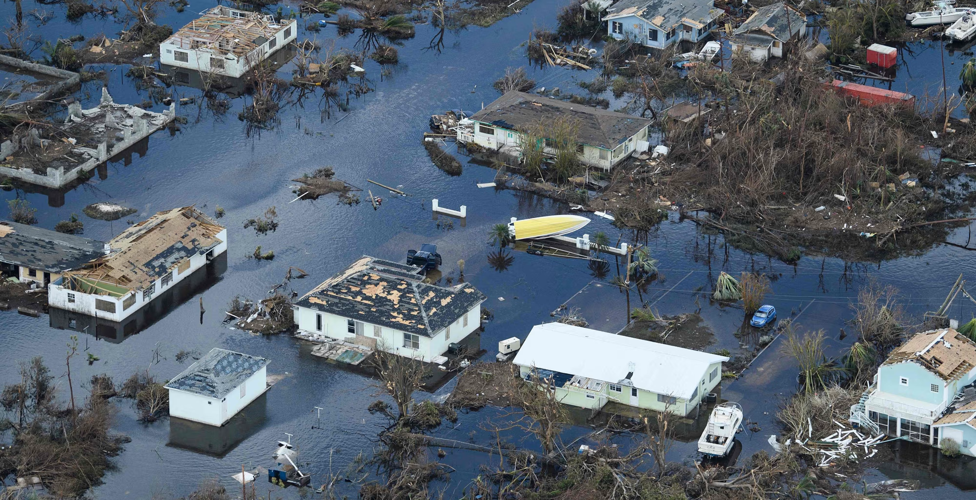
What this guide covers: Every hurricane season, Brevard County homeowners hear a storm’s “category” and try to guess what it means for the Space Coast. History says the category alone rarely tells the story. This guide walks through the storms that actually shaped Palm Bay, Melbourne, Titusville, Cocoa Beach, and Cape Canaveral, separating each storm’s peak strength from what Brevard truly experienced, using National Weather Service and Brevard County Emergency Management records, and drawing out what local homeowners learned each time.
Brevard County has taken direct hits, absorbed devastating near misses, and flooded under storms that never even reached hurricane strength. Understanding that pattern is the difference between preparing for a category and preparing for a coastline. Here is the record, and the lessons inside it.
✔ Brevard County Emergency Management Data
✔ Written by a Local Space Coast Installer
How to Read a Storm’s Impact on Brevard
The single most common mistake is judging a storm by the headline category. A storm’s peak intensity is measured at its strongest point, often hundreds of miles out at sea. What matters to your home is how close the core passed and what the local weather station actually recorded. Four patterns show up again and again on the Space Coast:
- Direct hit or adjacent landfall: the eyewall crosses or brushes the county. This is the Frances, Jeanne, and Nicole pattern.
- Offshore near miss: a powerful storm parallels the coast just offshore, sparing the worst but still delivering damaging wind and severe erosion. Matthew and Dorian.
- Cross-state crossing: a storm makes landfall elsewhere in Florida and weakens as it passes over or exits near Brevard. Ian and Milton.
- Large-field and rainfall events: the core stays far away but the outer bands, tornadoes, or stalled rain do the damage. Irma and Tropical Storm Fay.
Major Storms That Shaped Brevard County
| Storm (Year) | Peak Intensity | Track vs. Brevard | NWS-Reported Brevard Conditions | Impact Type |
|---|---|---|---|---|
| Frances (2004) | Cat 4 peak; Cat 2 landfall | Landfall to the south (Sewall’s Point); stalled ~18 hrs | Melbourne office gust 63 mph; 7.95″ rain; prolonged storm-force winds | Direct / adjacent |
| Jeanne (2004) | Cat 3 at landfall | Eyewall tracked over Brevard, 21 days after Frances | 90 mph sustained at Melbourne office; 3.8 ft surge at Port Canaveral | Direct hit |
| Fay (2008) | Tropical Storm | Crawled offshore just east of Melbourne; stalled | 27.65″ rain north Melbourne; 11″ in 24 hrs | Rainfall / flooding |
| Matthew (2016) | Cat 5 peak; ~Cat 3 offshore FL | Paralleled just offshore; eyewall clipped Cape Canaveral | ~100 mph gust at Cape Canaveral; lower inland; ~174,000 without power | Offshore near miss |
| Irma (2017) | Cat 5 peak; Cat 3 FL landfall (west coast) | Core up the west side; Brevard on the east flank | Tropical-storm-force winds, embedded tornadoes, widespread flooding | Large wind field |
| Dorian (2019) | Cat 5 peak (185 mph) | Crept north just offshore for days | Tropical-storm-force gusts; 3–5″ rain; moderate–major beach erosion | Offshore near miss |
| Ian (2022) | Cat 4/5 peak; Cat 4 FL landfall (SW) | Crossed the state, exited near Cape Canaveral as a TS | ~65 mph max sustained; 5–10″ rain (up to 12″); tornadoes | Cross-state crossing |
| Nicole (2022) | Cat 1 at landfall | Landfall just south of Vero Beach; eye crossed Brevard (Nov) | Tropical-storm conditions; 11+ ft offshore waves; severe erosion | Landfall / eye crossing |
| Milton (2024) | Cat 5 peak; Cat 3 FL landfall (west coast) | Crossed the state, exited ~10 mi NW of Cape Canaveral | Gusts 50–70 mph (to ~80 near coast); 1 confirmed tornado; 405 structures affected | Crossing + tornadoes |
Figures are drawn from National Weather Service Melbourne post-storm reports, National Hurricane Center tropical cyclone reports, and Brevard County Emergency Management. Full sources are listed at the end of this page.
2004: Frances and Jeanne, the Back-to-Back Season
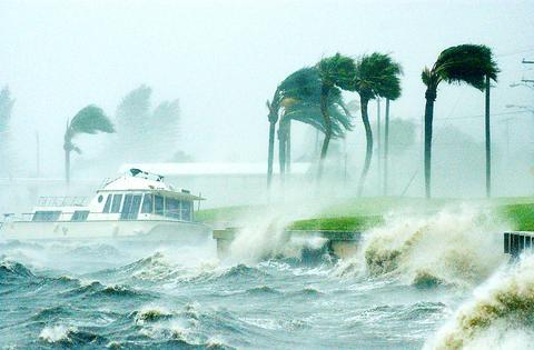
No season taught Brevard more than 2004. Hurricane Frances peaked as a Category 4 over the Atlantic, weakened to Category 2, and made landfall to the south near Sewall’s Point on September 5. What made it punishing was not peak wind but pace: the storm stalled for roughly 18 hours. The National Weather Service office in Melbourne logged a peak gust of 63 mph and nearly 8 inches of rain, but the real story was duration, with tropical-storm-force winds grinding on structures for the better part of a day and knocking out power to hundreds of thousands.
Then, just 21 days later, Hurricane Jeanne made landfall as a Category 3 within about two miles of where Frances came ashore, and its eyewall tracked across Osceola, Brevard, and Indian River counties. The Melbourne office recorded sustained winds of 90 mph, with a 3.8-foot surge measured at Port Canaveral. Homes that had survived Frances with minor damage failed under Jeanne, because the cumulative stress of two storms in three weeks overwhelmed structures that looked intact after the first.
What Brevard homeowners learned: A season is not one storm. Protection has to survive repeated deployment without a weekend of prep in between. Homeowners who had scrambled to hang plywood for Frances could not realistically re-hang it for Jeanne while exhausted and out of power. This is the season that sold the Space Coast on permanent hurricane shutters that deploy in minutes, not hours.
2008: Tropical Storm Fay, When “Just a Tropical Storm” Flooded Homes
Fay never became a hurricane, and it still ranks among the most damaging storms in Brevard’s modern history. After crossing the peninsula, Fay drifted offshore just east of Melbourne and stalled, wringing out round after round of rain. North Melbourne recorded an astonishing 27.65 inches, one of the wettest tropical-cyclone totals in Florida history, with 11 inches falling in a single 24-hour stretch. Hundreds of homes flooded, some under several feet of standing water, and low-lying neighborhoods sat submerged for days.
What Brevard homeowners learned: Wind and water are separate threats. A storm can carry a low category and still cause a flooding disaster, and shutters do nothing for rising water. Fay is why smart preparation pairs opening protection with a hard look at drainage, elevation, and flood insurance. Know your risk before the forecast, not during it.
2016: Hurricane Matthew, the Margin of a Wobble
Matthew peaked as a Category 5 in the Caribbean and paralleled Florida’s coast as a major hurricane, its western eyewall barely clipping the Cape Canaveral complex on October 7. A gust near 100 mph was recorded at the tip of the Cape, with likely sustained Category 2 conditions at the extreme northeastern edge of the launch complex; winds fell off notably inland. More than half of Brevard, roughly 174,000 customers, lost power, and the Cape sustained several million dollars in facility damage.
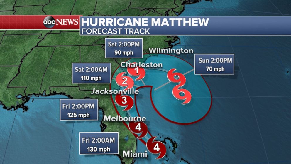
What Brevard homeowners learned: A few miles decide everything. Matthew was a genuine major hurricane whose worst stayed just offshore. The lesson is not “we got lucky,” it is that a slightly different track brings a Category 3 eyewall onshore, and you cannot prepare a home in the hours it takes a storm to wobble. Protection is a decision you make in June, not the night the cone shifts.
2017: Hurricane Irma, Damage From the Far Side
Irma made landfall on Florida’s southwest coast and tracked up the western side of the peninsula, putting Brevard on the storm’s eastern flank, well away from the core. It did not matter. Irma’s enormous wind field spread tropical-storm-force winds and spun up tornadoes across the Space Coast: a waterspout came ashore at Melbourne Beach with estimated 70 to 80 mph winds, and a tornado destroyed six mobile homes in Palm Bay. Heavy rain drove flooding across Palm Bay, Melbourne Village, and Grant-Valkaria that lingered for weeks in spots.
What Brevard homeowners learned: A west-coast landfall is still your storm. Irma proved that hundreds of miles from the eye, embedded tornadoes and a vast wind field can put your windows at risk. “It’s going to hit the other coast” is not a preparation plan on the Space Coast.
2019: Hurricane Dorian, Days in the Cone
Dorian was a monster, a Category 5 with 185 mph winds that devastated the Bahamas, and for days Brevard sat squarely in the forecast cone as it crept north just offshore. An eastward nudge kept the core over the ocean. The Space Coast came through with tropical-storm-force gusts, 3 to 5 inches of rain, and moderate to major beach erosion over several tide cycles, with around 1,600 customers losing power. The gap between a near miss and a catastrophe was measured in a handful of miles.
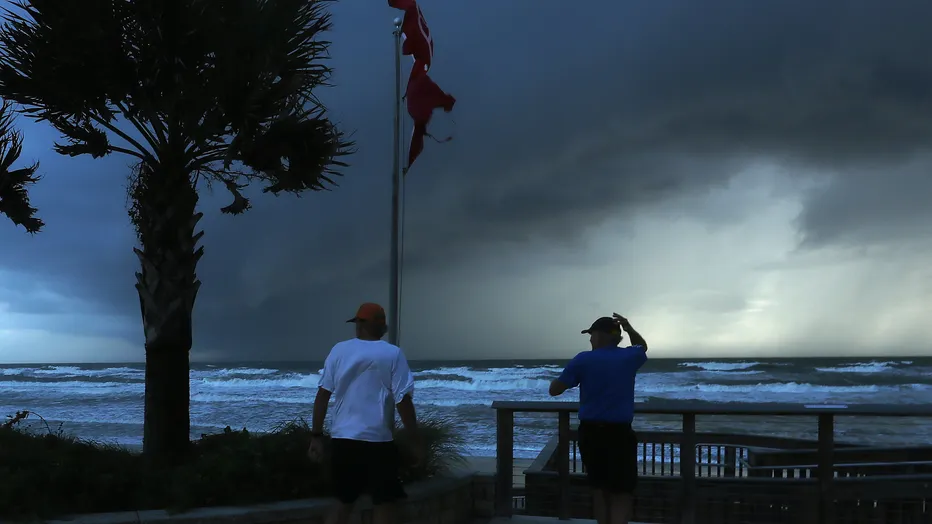
What Brevard homeowners learned: Days of uncertainty are exhausting and expensive when you are unprotected. Homeowners with permanent shutters watched Dorian from a secured house; everyone else spent a week deciding whether to board up. Preparedness buys peace of mind during the long wait, which is often the hardest part. See our preparedness guide.
Don’t Prepare in the Cone. Prepare Before the Season.
A local expert will walk your home and recommend the right protection for each opening, so the next time Brevard is in the cone, your prep is already done. Most Melbourne and Palm Bay homeowners get a quote within 48 hours.
2022: Ian and Nicole, One Season, Two Very Different Storms
Hurricane Ian made a catastrophic Category 4 landfall near Fort Myers in September, then crossed the state and exited near Cape Canaveral as a tropical storm. From 150 miles away at landfall, Ian still delivered maximum sustained winds around 65 mph to Brevard, dropped 5 to 10 inches of rain with some neighborhoods near 12, spun up tornadoes, and washed out roads. Damage was lighter than feared, but “lighter than feared” is not the same as “spared.”
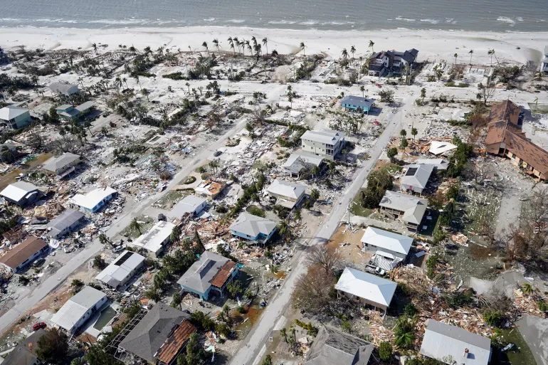
Six weeks later, Hurricane Nicole did something Ian did not: it made a rare November landfall just south of Vero Beach as a Category 1, and its eye crossed Brevard as a tropical storm. Nicole’s large, wet wind field drove waves over 11 feet offshore and inflicted severe beach erosion on a coastline already stripped by Ian, collapsing several coastal structures. A “Category 1” became a coastal disaster.
What Brevard homeowners learned: The season does not end on Halloween, and low categories still hurt. Nicole was one of the latest Florida hurricane landfalls on record and one of the most erosive events the Space Coast has seen. Keep protection ready through the entire season, and never dismiss a storm because the number is small.
2024: Hurricane Milton and the Tornado Threat
Milton peaked as a Category 5 in the Gulf, made landfall near Siesta Key as a Category 3, and raced across the state, with its center exiting roughly 10 miles northwest of Cape Canaveral before dawn on October 10. Brevard’s sustained winds and gusts generally ran 50 to 70 mph, reaching around 80 near the coast, and the county confirmed one tornado. Brevard County Emergency Management’s preliminary assessment counted 405 structures affected, including 33 with major damage, with no storm-related fatalities in the county. The larger story was the tornado outbreak Milton’s outer bands unleashed across the peninsula, dozens of tornadoes, with an EF3 striking Fort Pierce just to the south.
What Brevard homeowners learned: A weakening storm on the east side of the state can still spin up tornadoes with little warning. Tornadoes are exactly the fast, debris-driven wind events that rated hurricane shutters and impact windows are built to resist, and there is rarely time to prepare once a warning is issued.
City-Level Observations Across the Space Coast
- Palm Bay: repeatedly hit by tornadoes and inland flooding rather than surge, from the Irma mobile-home tornado to washouts in Ian. Inland does not mean immune.
- Melbourne: home to the NWS office whose readings anchor this record, and ground zero for Fay’s historic rainfall. Melbourne’s story is as much water as wind.
- Titusville: on the north end, it has felt prolonged wind in the 2004 storms and outer-band effects from the crossing storms, plus its own drainage-driven flooding.
- Cocoa Beach & the barrier island: the front line for erosion and surge, hammered by Dorian, Ian, and Nicole in successive years.
- Cape Canaveral: took the county’s strongest winds in Matthew and sat closest to Milton’s exit, a reminder that the northern coast often sees the highest gusts.
The Pattern Behind Twenty Years of Storms
Read together, these storms make a consistent case. Brevard’s damage rarely comes from a textbook direct hit; it comes from stalls, wobbles, outer bands, back-to-back seasons, and late-season surprises. Four lessons hold up every time:
- Category understates local risk. Fay and Nicole did major damage at tropical-storm and Category 1 strength.
- Every opening matters, garage included. A home is only as protected as its weakest point, and cumulative storms find it. Not sure which product fits which opening? See our guide to hurricane shutter types.
- Permanent protection beats last-minute prep. The 2004 and Dorian experiences favored homeowners who could secure the house in minutes with shutters or hurricane screens, not hours with plywood.
- Protection pays you back. Code-approved systems can also lower your premiums. See how on our Brevard County insurance discount guide.
- Budget before the season starts. Whole-home protection runs $1,500 to $25,000 depending on product. See what hurricane shutters cost in Brevard County.
Frequently Asked Questions About Brevard County Hurricanes
When was the last time a hurricane directly hit Brevard County?
Hurricane Nicole made landfall just south of Brevard near Vero Beach in November 2022, and its eye crossed the county as a tropical storm. For a strong eyewall passage, Hurricane Jeanne in September 2004 tracked its eyewall directly across Brevard as a Category 3.
What was the worst hurricane in Brevard County history?
Most longtime residents point to the back-to-back blow of Frances and Jeanne in 2004, which struck 21 days apart and caused compounding damage. For flooding specifically, Tropical Storm Fay in 2008 set rainfall records, with north Melbourne recording over 27 inches.
Does Brevard County get direct hurricane hits or mostly near misses?
Both. Brevard has taken direct and adjacent landfalls (Frances, Jeanne, Nicole) and absorbed powerful offshore near misses (Matthew, Dorian). It has also been hit hard by storms that made landfall elsewhere, like Irma, Ian, and Milton. The damage often comes from the storms people expect the least.
Can a tropical storm really cause serious damage here?
Yes. Tropical Storm Fay never reached hurricane strength and remains one of Brevard’s most damaging storms because it stalled and flooded hundreds of homes. Wind category does not capture rainfall, tornado, or erosion threats.
When does hurricane season affect Brevard County?
The Atlantic season runs June 1 through November 30. Brevard’s history spans that whole window, from late-August Fay to a November Nicole landfall, so protection should be in place for the entire season, not just the September peak.
Sources
This history is compiled from primary meteorological and government records rather than secondary summaries:
- National Weather Service, Melbourne FL, post-storm reports and event surveys (Frances, Jeanne, Fay, Matthew, Irma, Dorian, Ian, Milton)
- National Hurricane Center Tropical Cyclone Reports (Jeanne 2004, Fay 2008, Matthew 2016, Nicole 2022)
- Brevard County Emergency Management damage assessments and flood-risk resources
- Florida Climate Center (FSU) storm reports (Ian 2022, Nicole 2022)
Serving the Entire Space Coast
Brevard Hurricane Protection has helped homeowners across Melbourne, Palm Bay, Cocoa Beach, Titusville, Rockledge, Satellite Beach, Viera, Merritt Island, and surrounding Brevard County communities prepare for exactly the storms in this record. Every installation is permitted, performed by licensed and insured contractors, and documented for your wind mitigation inspection, so you are ready before the next name is on the map.
Get Your Home Storm-Ready
No sales pressure. No hidden fees. Just a clear quote from a local expert who has seen what these storms do to Brevard County homes.